The Need

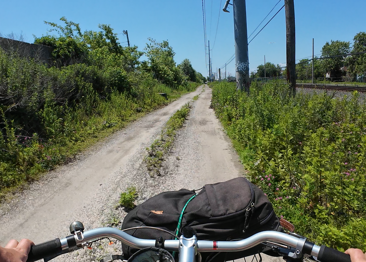
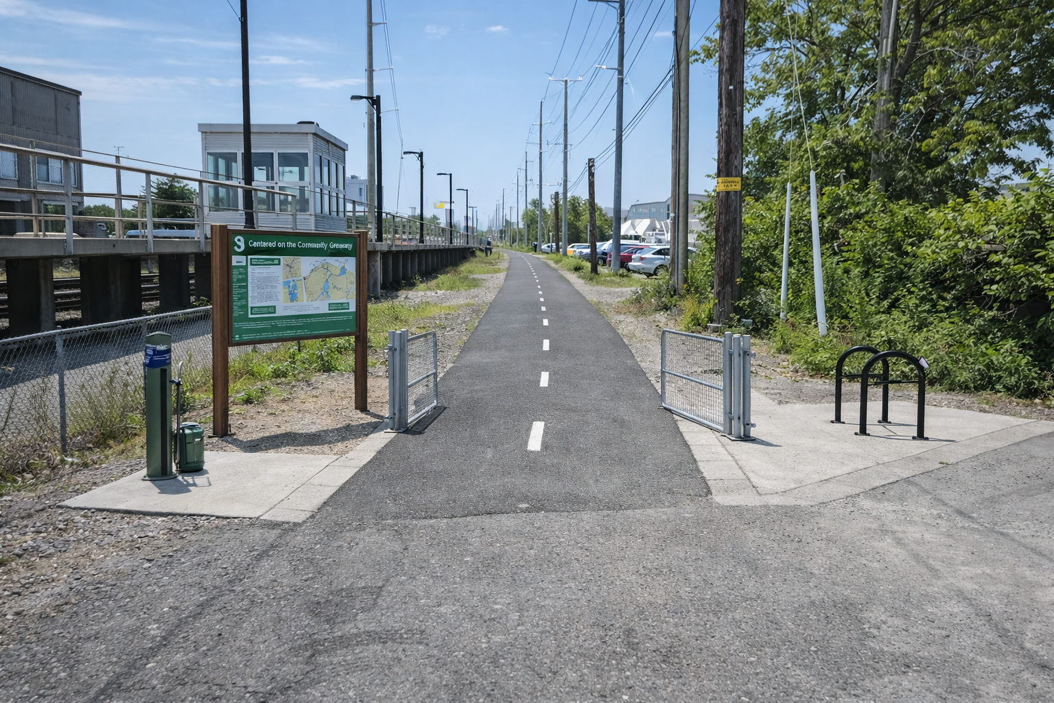
Converting the one-mile dirt service road into a paved multi-use path would provide residents with a safe and direct way to access the train station while also serving as a vital link for those looking to reach the beach without relying on cars. Upgrading this path would not only benefit the community but also support the LIRR by improving its ability to access and service the train tracks in a more reliable manner. The project can be designed so that the LIRR retains full control and the ability to close the path whenever operational needs require, ensuring their work is not interrupted. This dual benefit makes the improvement of the path a practical and community-focused investment.
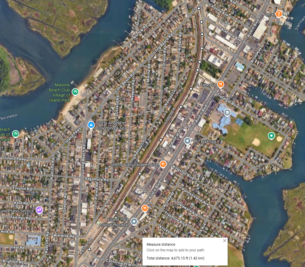
The Route
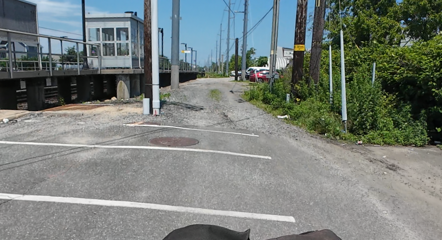
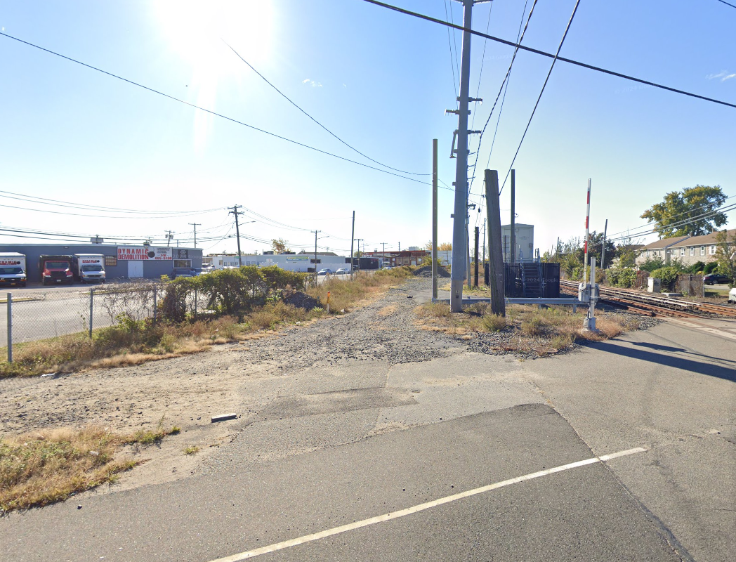
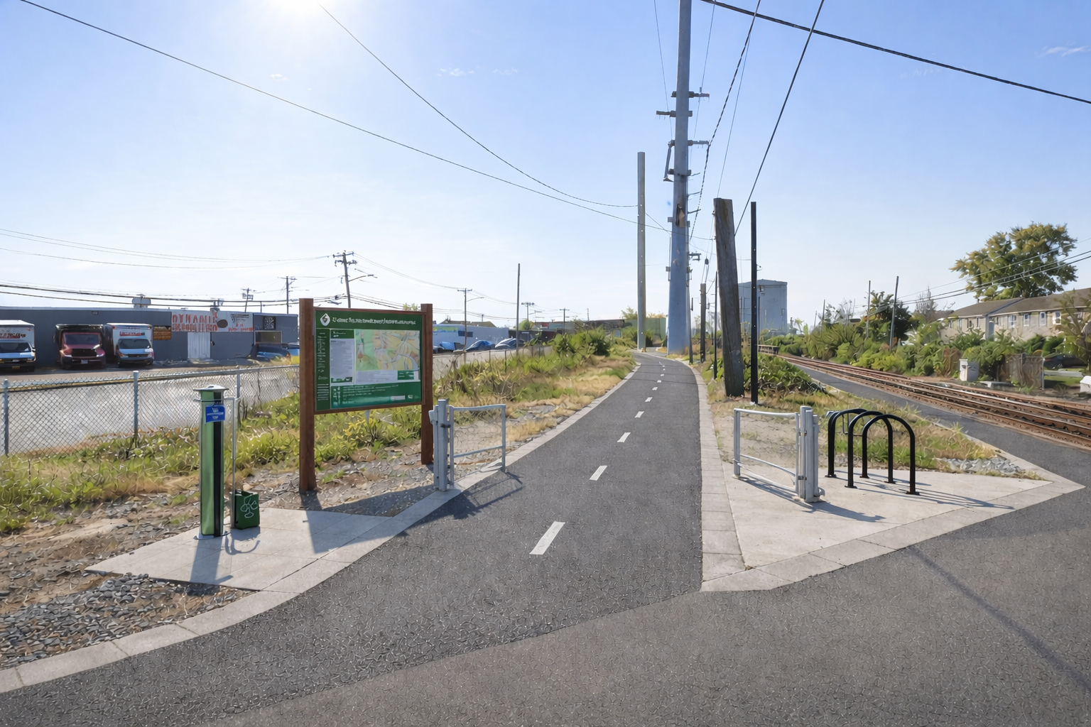
This multi-use route is just under one mile long and offers a completely car-free connection for both pedestrians and cyclists. The northern entrance is located just south of Saratoga Boulevard, while the southern entrance sits within the Island Park LIRR Station parking lot. By linking directly to the train station on one end and the Ace Shopping Center on the other, the path provides residents with safe, convenient access to two major community destinations. Fully separated from traffic, it creates a reliable north–south corridor for everyday travel and recreation, and it also serves as a key section of the greater path that will connect residents directly to Long Beach.
Importantly, this project would be a vital way to increase the capacity of this travel corridor without affecting car travel in any way. The area is currently poorly maintained and often used for illegal dumping, but transforming it into a community path would bring regular use, keep eyes on the space, and improve overall quality of life for nearby residents.
The Funds
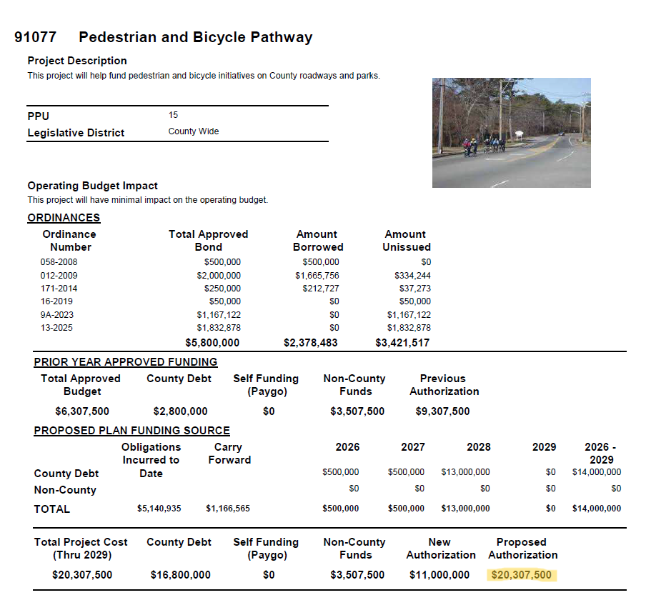
Nassau County has already allocated up to $10 million in its current capital plan, with funding available through 2028, for the development of bicycle infrastructure. The money is there. What’s missing is follow-through. Now is the time to hold the county accountable and ensure these funds are used to create safe, functional bike routes that serve the community.
Additionally, because the route doubles as a service road for the train tracks, there is potential for the LIRR to contribute to the project’s funding, as the improvements would enhance both community access and railroad operations.