The Need
For years, both New York State and Nassau County have recognized the potential of a continuous multi-use pathway running parallel to Sunrise Highway. Nassau first proposed the plan in their 2010 Comprehensive Master Plan and the State has included it as a vision project in multiple “Moving Forward” plans. While the idea has been proposed multiple times, it has never moved beyond the earliest planning stages, leaving only scattered and poorly maintained segments that fail to create a usable route. A complete and continuous path from Valley Stream to Massapequa Park would finally bring this vision to life.
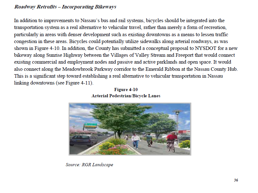
This corridor runs directly through the heart of the south shore, connecting a series of vibrant downtowns, transit hubs, schools, and parks. A safe, dedicated path would open up a critical non-car travel option, allowing people to walk, bike, or use mobility devices without the dangers of sharing space with high-speed traffic. Instead of being forced to rely on cars for short local trips, residents would gain a reliable and accessible alternative that enhances both safety and convenience.
By linking communities across nearly the entire south shore, the path would become one of the most important pieces of active transportation infrastructure in Nassau County. It would not only provide a healthy and sustainable way to get around, but also help reduce traffic congestion, support local businesses, and improve quality of life for residents of all ages.
The Route
The proposed multi-use path would stretch the full width of Nassau County’s south shore, running from Valley Stream in the west to Massapequa Park in the east. Much of the section from Valley Stream to Freeport is already established, meaning it would require significantly less funding and construction to complete. This makes it a natural candidate for Phase 1 of the project, allowing the benefits of the pathway to be realized more quickly while building momentum for the full corridor. For most of its length, the route would run directly alongside Sunrise Highway and the Long Island Rail Road’s Babylon Branch, where space already exists for a continuous pathway. In certain areas where the corridor becomes more congested, the route would need to veer off slightly, but the goal is to maintain a direct and seamless connection across communities.
Along the way, the path would pass directly through Valley Stream, Lynbrook, Rockville Centre, Baldwin, Freeport, Merrick, Bellmore, Seaford, Wantagh, Massapequa, and Massapequa Park. Each of these communities has a vibrant downtown centered around its LIRR station, making the route an unparalleled opportunity to connect residents, businesses, and transit hubs. By linking these downtowns with a safe, dedicated pathway, the project would create a new spine for active transportation across Nassau County’s south shore. These towns and villages have a combined population of approximately 250,000 residents.
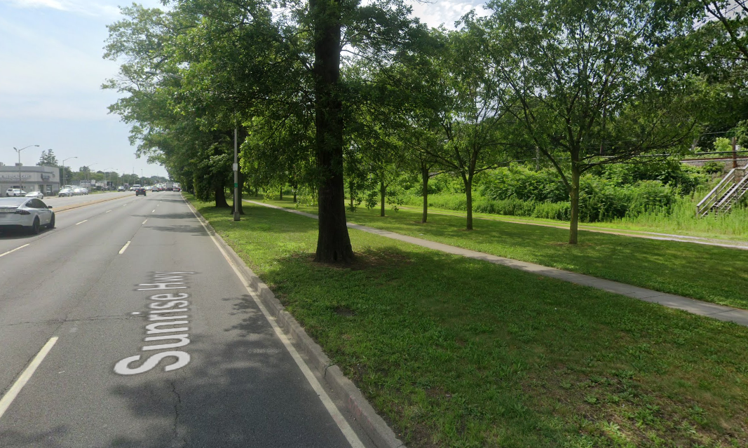
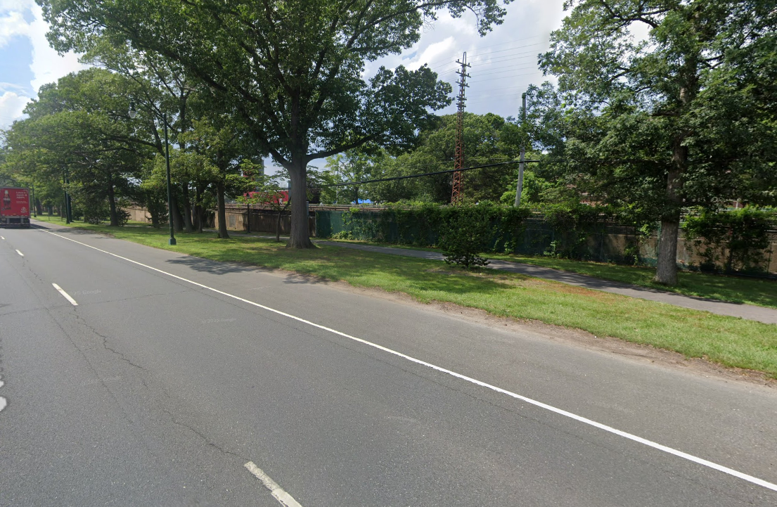
Importantly, several stretches of the route already exist today. Sections from Valley Stream to Lynbrook, Rockville Centre to Baldwin, and Baldwin to Freeport are in place, though they remain fragmented and often poorly maintained. Building the full path would not only connect these isolated pieces, but also upgrade them into a consistent, high-quality corridor that people could confidently use for commuting, errands, or recreation.
In addition to connecting communities along the south shore, this multi-use path would also link with existing north-south routes, such as the Bethpage Bikeway in Massapequa. By providing a major east-west spine, the path could serve as a catalyst for the development of additional north-south connections, creating a more comprehensive network of safe, non-car travel options throughout Nassau County. This expanded connectivity would further enhance mobility, recreation, and access to transit for residents across the region.
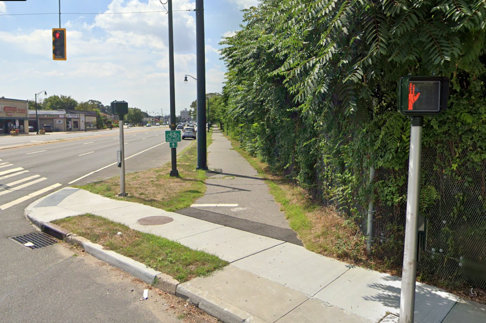
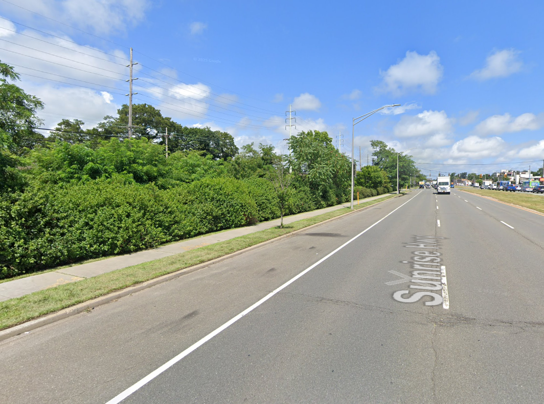
Shown are photos of the existing conditions in Valley Stream, Lynbrook, Rockville Centre/Baldwin, Freeport and Merrick respectively.

The Funds
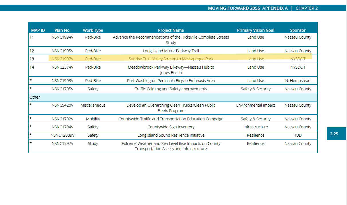
A project of this scale would require collaboration and funding from multiple levels of government. Primary funding could come from Nassau County and New York State transportation and infrastructure programs, including grants for pedestrian and bicycle improvements, complete streets initiatives, and sustainable transportation. Additional funding opportunities could be explored through federal programs, such as the Transportation Alternatives Program (TAP) or the Congestion Mitigation and Air Quality (CMAQ) program.
Because the path passes through multiple villages and unincorporated areas, successful implementation would require careful coordination between local municipalities, the county, and state agencies. Each village would need to collaborate on design, permitting, and ongoing maintenance, while the county and state would provide oversight, funding, and alignment with regional transportation priorities. Thoughtful coordination would ensure that the path is continuous, safe, and integrated with existing infrastructure, while maximizing the impact of public investment.